Shafer Trail Through the Canyon
Part of the album: The Small Hikes
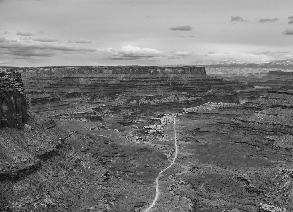
The Shafer Trail ends where there's a fork in this photo. To the left is out to Potash Road, to the right is the White Rim Trail which is about 100 miles long and requires a permit. Someday we'll come back and get a permit and do some camping and do the White Rim Trail.
The Shafer Trail ends where there's a fork in this photo. To the left is out to Potash Road, to the right is the White Rim Trail which is about 100 miles long and requires a permit. Someday we'll come back and get a permit and do some camping and do the White Rim Trail.
Related Photos


Photo Location
The map failed to load!
 7.24 mi
 3.6 hrs
 6,252 ft
 860 ft
View Graphs