Stunningly Devastating
I've wanted to go back to Storm Mountain ever since we hiked it in the spring of 2020. It was such a gorgeous hike with decent views (particularly on the drive to the trailhead), it's in a secluded area where we wouldn't be around too many people, and not too far of a drive from our home. But with the Camerons Peak fire engulfing that area shortly after we hiked it in 2020, we weren't able to get back there until now. This area was just starting to recover from the South Canyon Fire in 1994 before getting scorched again in 2020 from the Cameron Peak fire. Although I don't know how bad the area burned in 1994, it seemed like the Cameron Peak fire did much more damage to this area.
The weather was a little more cooperative this time compared to when we hiked it in 2020. With less snowfall in the area this spring the trail was almost completely dry with just a few areas with a small amount of snow on the trail. I would have rather had the snow and gone snowshoeing, but when we hiked this last, we were underprepared without snowshoes even though we were in desperate need of them. So being able to hike on the muddy ground made it a much more pleasant hike that allowed me to focus on the devastated burned area.
We were hiking along the steepest section when we finally rounded a corner and the elevation gain flattened out for a little bit. It was only after we were able to catch our breath and actually look up instead of starting at the ground that we realized we hiked into the first burned section along the trail. We could see some of the fire damage in the distance from the beginning of the hike, but we weren't anywhere near it until almost a mile into the hike. I remember this hike being covered in dense trees at almost every point during the hike, but now we had almost wide-open views except for the slender burnt trees that were once covered in pine needles. It was truly a surreal experience none like I've ever experienced before. I hope this area gets a little more time than 16 years before its next fire.
 5.16 mi
 2.1 hrs
 10,008 ft
 1,437 ft
Patchy Color
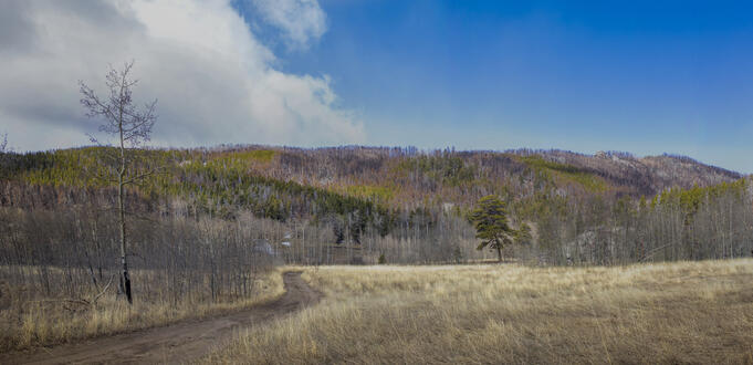
Right from the start of the hike we were greeted with fascinating landscapes that showed the burned area.
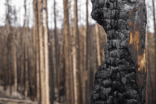
Burnt
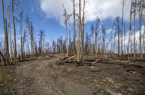
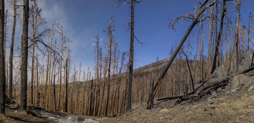
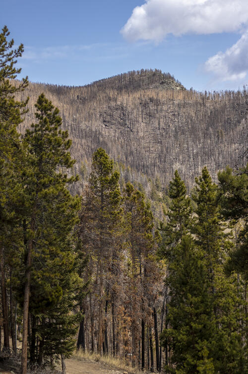
We finished the steepest section of the hike, then rounded this corner to a devastated area of dense trees all burnt to a crisp.
Burned Trees Everywhere
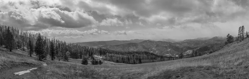
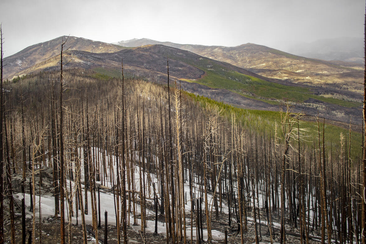
As we kept hiking, we continued through a burned area pretty much all the way to the summit. It was gorgeous in a very sad way.
The Meadow
The meadow didn't seem to have been burnt, but then again, since it was a meadow, there probably wasn't much to burn. This area looked very similar to when we had hiked it in 2020, although you can see some of the trees off to the left burnt in this panorama.
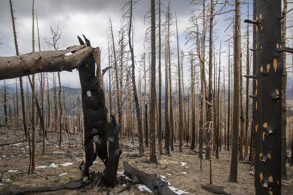
Holy and Spotty
The tree left of center grabbed my attention from the trail. The way it burned was so unique poking holes in the three. The spotted tree to the right added some interesting texture to the composition.
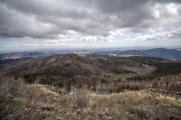
Overlooking
This photo is taken from where we thought the top was when we hiked this in 2020. Because there was deep snow, we didn't realize that you could climb up even further.
Heading Back
On the way back from the hike I stopped to take a few photos. There are other photos in this album from the same area, but this one provided different lighting enough that I wanted to take some more photos.
Pokey
The top of this mountain was completely burned, leaving just some pokey trees off the top of it.


