Crosier Mountain Via Devils Gulch Road
We haven't been hiking in a couple of weeks. With Katie starting her new job and us only having Sundays together without either of us having to work, it's hard to get everything we want to do together done in just one day. But since we didn't go hiking the week prior, we knew we had to go this weekend!
Summiting Crosier Mountain is no easy task. First, you have to pick one of three different trailheads, all of which are over 7 miles in round trip length and over 2,000 feet of elevation gain. We thought we were picking the shortest and least steep of the three trailheads, but our hike ended up being 9 miles and 2,100 feet of elevation gain. The maps lied to us with the distance but we made it none the less and I'm pretty sure the other 2 trailheads would have been even longer and steeper.
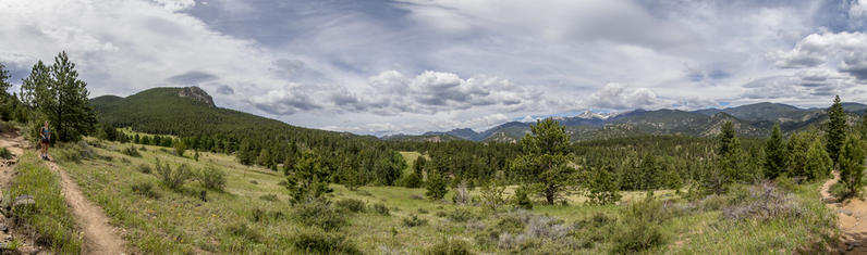
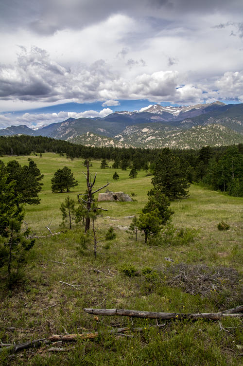
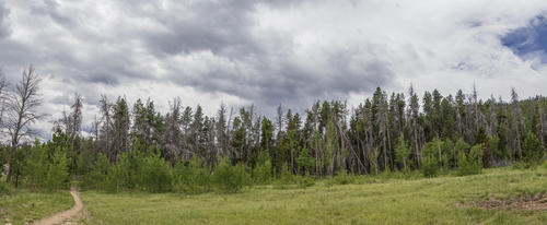
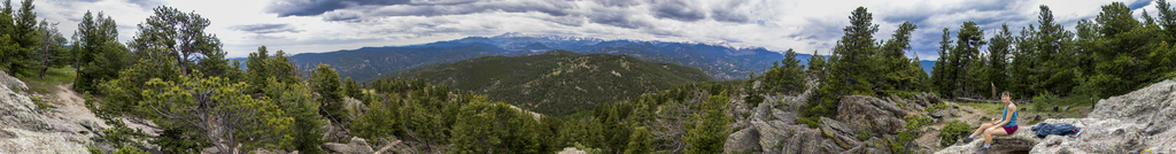
We did the 9-mile round trip hike in just over 4 hours. The weather ended up being perfect. It was a little hot and sunny for the first couple of miles, then overcast for the rest of the hike with cooler low-70° temperatures and just a tiny bit of rain sprinkles. We stopped for 30 minutes at the summit to eat a late lunch and to rest a bit before heading down. The hike had everything from a large meadow with awesome views of the Mummy Range to dense woods, both alive and completely and eerily dead, and a spectacular summit panorama.
 8.47 mi
 4.1 hrs
 9,137 ft
 2,162 ft
Knaps Knob
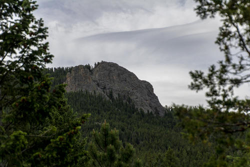
This rock feature was the first thing we saw from the meadow thinking it was Crosier Mountain. It looked really far and really high up. Crosier Mountain is higher and further (behind) than Knapps Knob.
Hairy
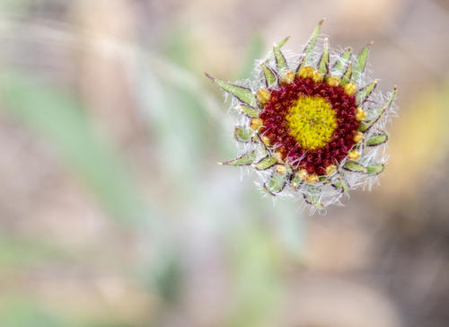
I think this is a Red Dome Blanketflower that's just starting to bloom. The hairs on it look like there's a spiders web around it.

Deat Trees
This part of the hike was pretty green with mostly live trees. But the scene changed when we got a little further in.
Piper Meadows
After a little over a mile in, we came across Piper Meadow. We hiked around it instead of through it since the meadow is owned by the H Bar G Ranch.
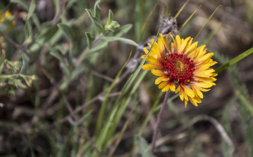
Red Dome Blanketflower
Storms Rolling In
These clouds weren't anything threatening to us, so we kept hiking. They provided lovely shade from the hot sun and made my photos have more texture without being washed out.
Resting
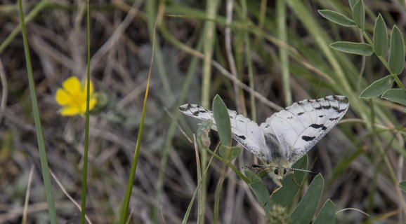
I love how this butterfly decided to rest on some leaves instead of the flower just out of focus.
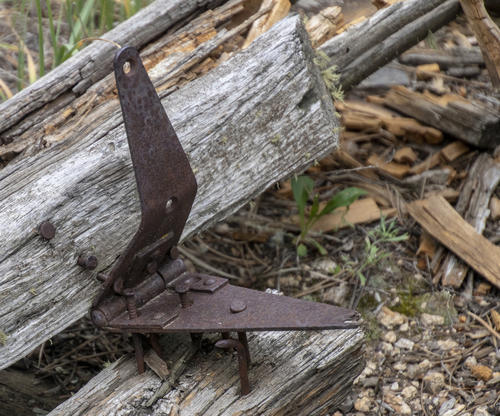
Rusty Hinge
Since part of the hike was hiking around a ranch, there were some rusty metal in a few places on the hike.
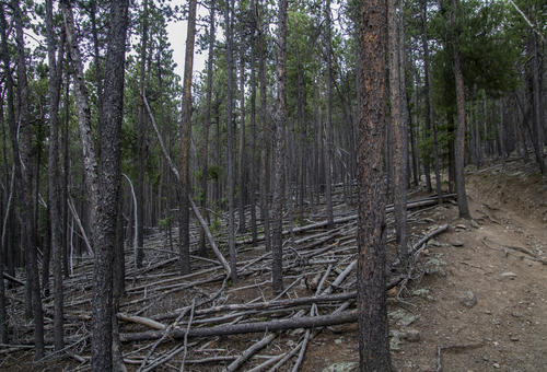
Forrest of Fallen Trees
Towards the last mile and a half of the hike, we came across an eerily forest with lots of dead trees. I would love to photograph this when there's some fog (but I'm not hiking this again anytime soon, nor am I hiking it that early in the mornign!).
Pine Beetle
This area is obviously affected by the pine beetle in a negative way.
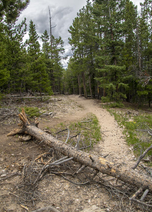
Fork in the Trail
This tree must have fallen a while ago. hikers made their own path around it instead of climbing over it.

Summit Direction
Once we got to this point, the trail got really steep. It was a painful and slow ascent the last half mile of the hike to the top from here.
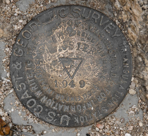
Survey Marker
It's always cool to find the survey markers of the mountains that you hike to. Just confirmation that you didn't get lost.
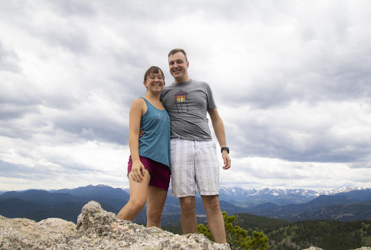
Sumit Selfie
We might look happy, but we're exhausted and sweaty (I was at least in this photo).
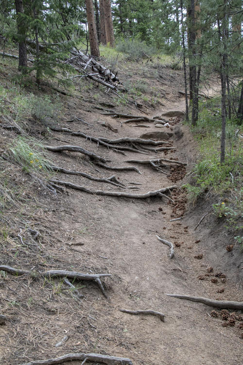
Roots
The trail has quite a bit of erosion on it in places. So much that the roots are showing.


