Camelback Mountain
While visiting Katie's family in Arizona, we decided to take some time to enjoy the outdoors since this is the only time of the year that you can be outside in Arizona without melting. With the temperatures in the mid 40's it could have been a little warmer, but that's still more than double the temperature that we're used to hiking in this time of year.
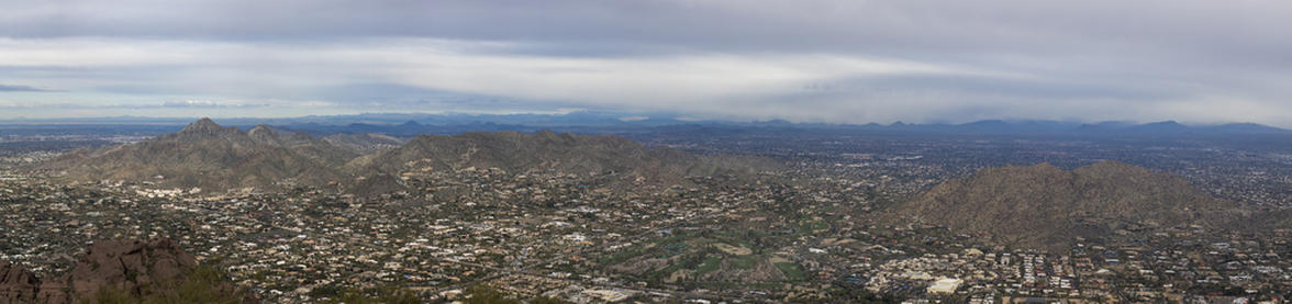
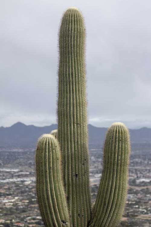
Katie picked the hike and it was a lot of fun. This hike packed A LOT of elevation gain in a very short distance, and that's apparent from the big caution sign at the beginning of the hike with two black diamonds on it with big bold letters saying that this is an "extremely difficult hike". But since we were hiking at a much lower elevation than we're used to, the hike seemed fairly easy considering what it was. We haven't done a lot of hiking near sea level, but it amazes me how much easier it is to catch your breath after doing a strenuous section. But the main reason that this hike was a lot of fun was because of the amount of rock scrambling that was required. The last half-mile to the summit we were using our hands in order to make it to the top. There aren't typically a lot of hikes in Colorado like that which made this hike extra fun. The worst part about this hike was the proximity to the city. We never really got far enough from the city where we couldn't hear city noises, but to be fair, this hike is right in the middle of Phoenix. But because of this, we got fantastic views of the city from the summit, which is a lot different than the views that we're used to getting at the summit. So I appreciated the different views than what I'm used to (let alone the cactus instead of the trees, which was cool too).
This hike has two different trailheads that one can start from. We started from the East side of the Cholla Trailhead because it was a little less elevation gain than starting on the West end. The hike to Camelback mountain from the Cholla Trailhead was also a little bit longer than the other trailhead, but that extra distance was probably better to spread out the elevation gain anyway.
 3.08 mi
 2 hrs
2 hrs
 2,618 ft
 1,312 ft
Papago Park
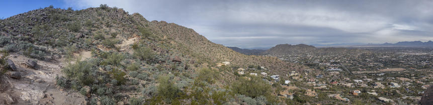
No matter what direction we looked on the hike there were some kind of mountainous feature, either in the foreground or in the distance.
Along the Trail
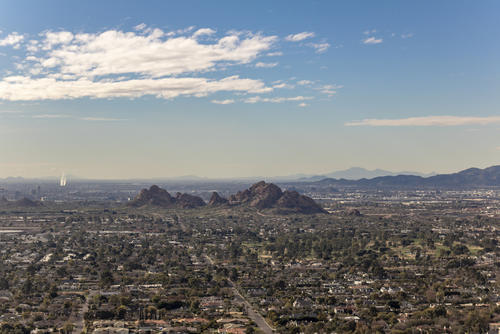
AS you can see from the photo, we were hiking in the middle of the city.
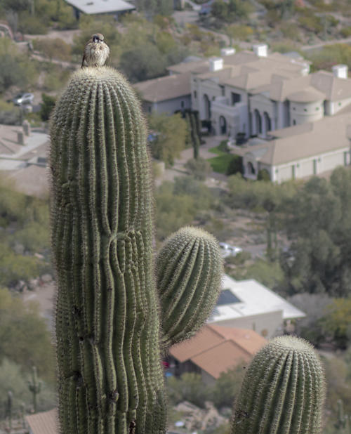
Perched
I can't imagine that it's very comfortable for this bird to sit on top of a cactus, but I guess if it wasn't comfortable it wouldn't stay there!
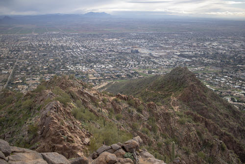
Looking Back
When we were about 3/4 of the way to the summit we started getting great views of the trail we had hiked on.
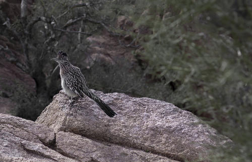
Roadrunner
We found a roadrunner bird at the summit. He was very cautiously curious of all the hikers, probably looking for food.