Mestaa'ehehe Mountain
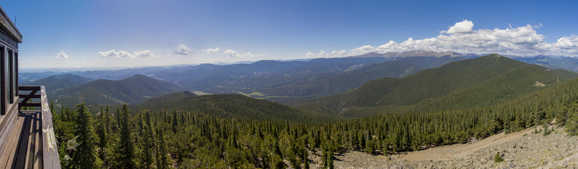
We had a pretty busy weekend between going to yoga on Saturday morning, Participating in breaking a world record, Cirque Du Soleil on Saturday afternoon, this hike on Sunday morning/afternoon, and then engagement photos on Sunday evening. However, we still wanted to get out of the house to enjoy the mountains. Because we had lots of things going on, we picked a pretty quick hike that was supposed to be a little over 4 miles but ended up being just over 3. Mestaa'ehehe Mountain is in the I-70 corridor, a place we haven't hiked before. Just outside of Idaho Springs in the Mount Evans Wilderness area, Mestaa'ehehe Mountain has a fire tower at the top that people can rent out. No one was in the fire tower when we summited, but we were able to get up on the observation deck which was pretty neat. A little bit to the North from the fire tower there are some large cellphone towers and another area that we hiked to in order to get panoramic views looking North towards the Indian Peaks mountain range.
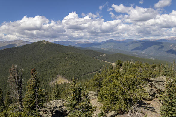
The hike was different than the typical hikes we've been doing. We usually don't venture this far South for hiking, and because of that, the mountain range was a little different than what we're used to. The most notable difference is that the Mount Evans area has much denser and taller trees. I'm guessing that area is a little bit older and hasn't been burned by a forest fire in quite some time (maybe because of people on watch at the Mestaa'ehehe fire tower), but it was interesting to hike in a different area of Colorado.
 3.13 mi
 1.6 hrs
 11,470 ft
 771 ft
Dense Trees
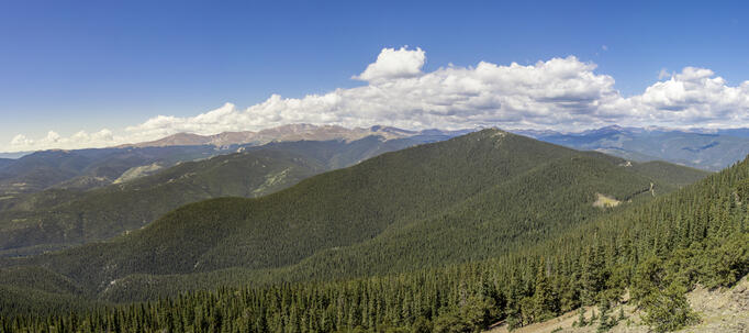
You can see Mount Evans in the distance. The green mountain in the foreground is Chief Mountain.
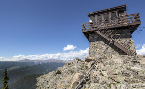
Fire Tower
The fire tower on top of Mestaa'ehehe Mountain was not that tall, but it didn't need to be to have panoramic views of the surrounding mountains.
Chief Mountain
The other option for today's hike was Chief Mountain. It is about the same height as Mestaa'ehehe Mountain but is a much shorter hike (with the same elevation gain).
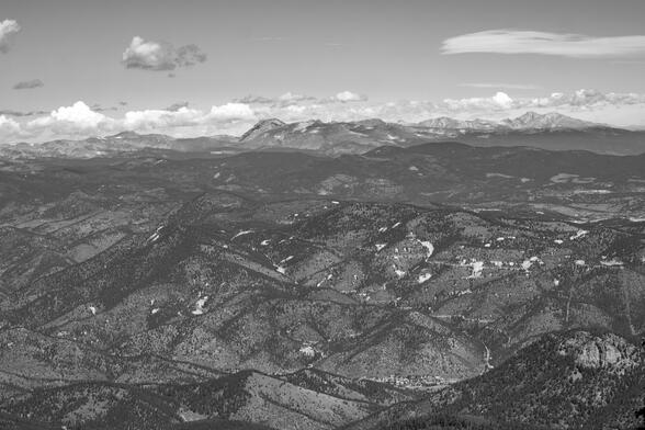
Longs and Meeker
I was surprised that we could make out Longs Peak and Mount Meeker in the distance (the highest and furthest back mountains next to the right edge of the photo). The small town at the bottom of the image is Idaho Springs.


