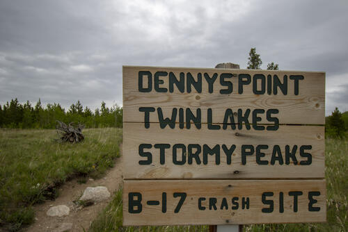
B-17 Crash Site Hike
It's been a while since we've done a real hike, so we wanted to get into the mountains and get back in the groove of things. The weather this weekend wasn't very cooperative, but we decided to go out and risk it anyway. The area that we wanted to hike in, Pingree Park, had a chance of rain all day but only 0.06" of rain was predicted, so we figured we would risk possibly having to end up hiking in the rain.
The drive to Pingree Park takes almost 2 hours from our house, mostly because the last 10 miles are on a dirt road. we got to the trailhead around 11 am and started on what would become a three-and-a-half-hour hike that took us through a beautiful area of Rosevelt National Park. The last time we were here (and the only other time I've been in this area) we were planning on doing this hike to the B17 crash site but we ended up taking the wrong turn and did a different hike instead. Ever since that hike last year I've wanted to come back to this area because it's such a peaceful area. Since it's so far from any city, most people don't hike up this way, which showed since we only saw three groups of people on the hike.
The hike started in poor weather. It was in the low 60's, quite windy, and starting to spit rain a little bit. We threw on our rain jackets and started the hike knowing that the weather would clear up since it was pretty light in the Western sky. It didn't take long for the weather to change from almost uncomfortably cold to hot with the sun beaming down on us. That's just part of the fun of hiking is having to take some risks when it comes to the weather. Luckily, the sun didn't stay out during the entire hike, but instead, it was partially cloudy the whole hike. The temperatures grew about 10 degrees during the hike and the wind stopped, making the start of the hike slightly uncomfortable from it being too chilly to being slightly uncomfortable from being too hot.
We got to the crash site around 12:30 and saw and ate our packed lunch. After lunch, I wandered up higher to get a better view of everything. There were quite a bit of airplane parts scattered around the area. There were 3 engines, both landing gear wheel assemblies, a big chunk of the deck that runs through the center of the plane, and a few other random assemblies and parts scattered here and there. There wasn't enough metal scattered around to make up a whole plane, so I speculate that after the crash some parts were air-lifted out of there to prevent things like oil and gas from leeching into the ground. Even though I was hoping to find more parts, it was still fascinating to see the carnage so spread out and to see what assemblies survived the crash and what didn't.
 6.3 mi
 3.6 hrs
 10,294 ft
 1,240 ft
Start of the Hike
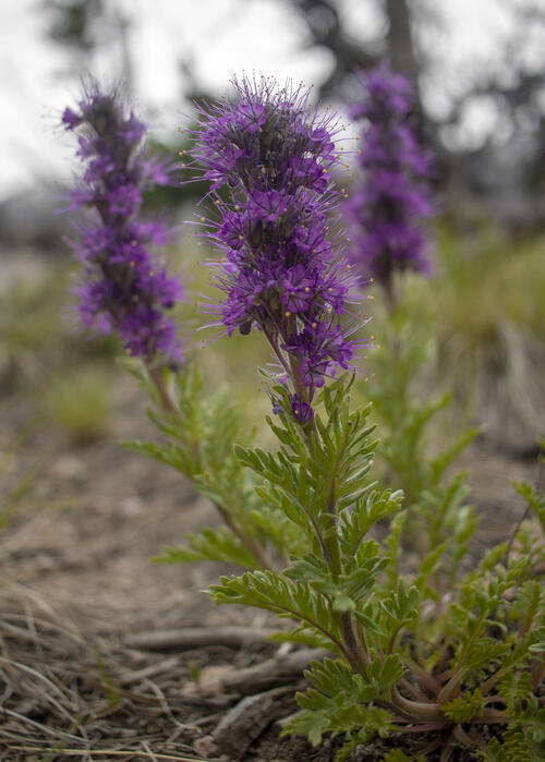
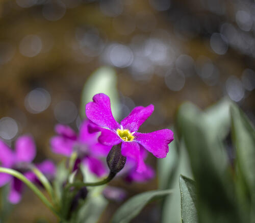
Purple Fring
There are still wildflowers at the higher elevations which made my happy since things are already starting to die at lower elevations.
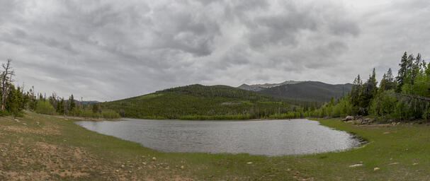
Twin Lake Reservoir
Twin Lake Reservoir is pretty early in the hike, and to continue off to the B-17 Crash Site you round the West (right in the photo) side of the lake.
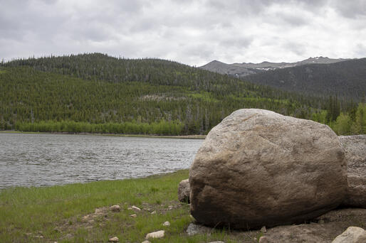
Boulder on the Lake
Along the West bank of Twin Lakes Reservoir there is a large boulder that adds some interest. Stormy Peak is the tall peak in the background.
Parry's Primrose
Along the river there were plenty of Parry's Primrose growing. I love the bokeh that is created by the flowing water in the background.
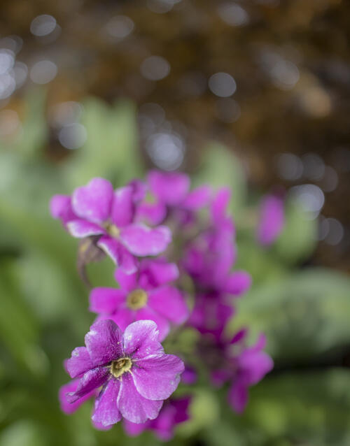
Sun Washed
All of the Parry's Primrose flowers along the river were starting to get sun washed and past their peak bloom.
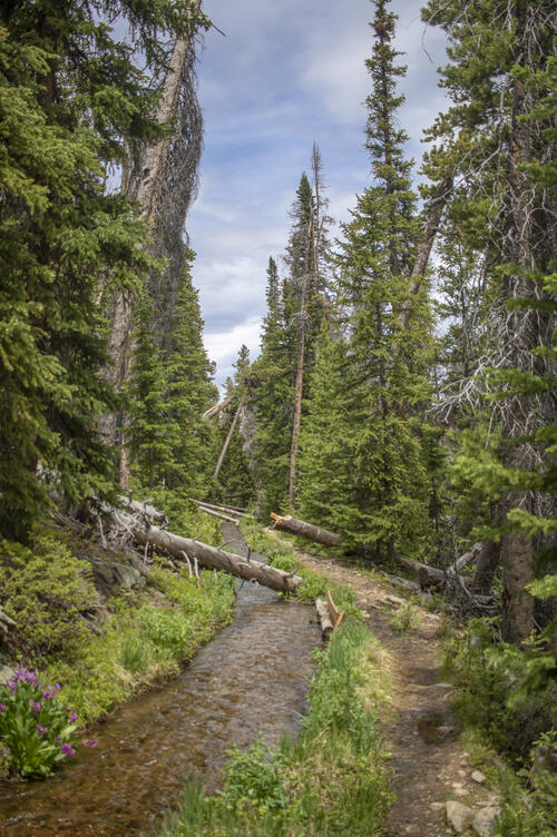
Path Along the River
There was a man-made river that flowed by the trail. We didn't know it was a man made river until we got to the end of the river, in which there was a dam diverting water along the path instead of down the mountainside.
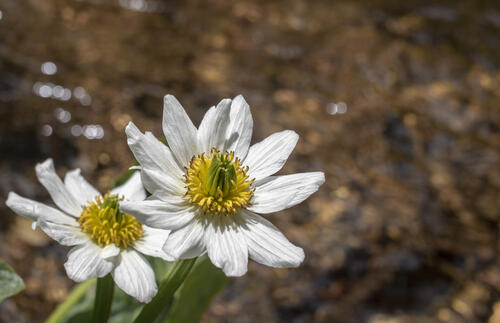
Unknown
I spent a long time trying to figure out what type of flower this is, but sometimes flowers are just so generic that they're hard to identify. The best I could come up with is that it might be some kind of Aster Flower.
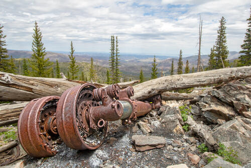
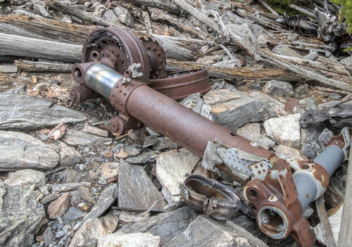
Landing Gear
Both sets of landing gear were easily identifiable. There was even still some rubber from the rotted wheels scattered further down the crash site.
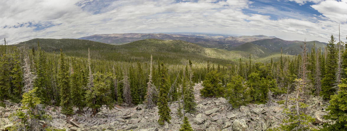
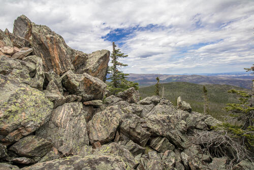
Rocky
I climbed to the top of this rock feature to get some panoramas of the B-17 crash site area. You couldn't see many of the components from this high up, but it gave a great view of the surrounding mountains.

Uneven Rusting
I was curious about the uneven rusting of these nuts bolts. Some of them still have the coating protecting them from rust and some are completely rusted.
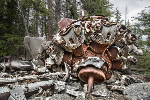
Main Engine
The coolest piece of equipment left from the plane was one of the 4 main engines mostly in tact. There were 2 other engines (for a total of 3), but the other two weren't in nearly as "good" of condition as this one.
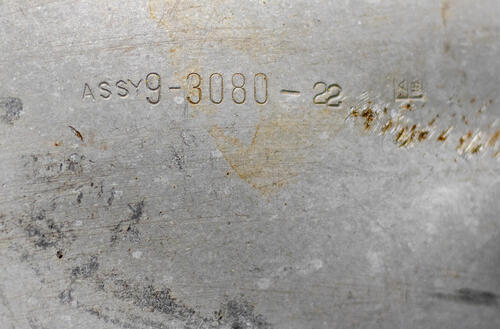
9-3080-22
I found a part number stamped on the side of the engine as assembly 9-3080-22. It would be really neat to have an assembly drawing of this to try and identify some of the parts. I'm sure that drawing exists somewhere.
Rotting Rubber
The rubber was rotting away on this piece of landing gear.
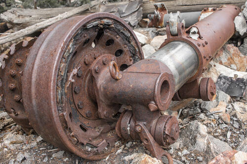
Landing Gear Cylinder
The cylinder that extends the landing gear was pretty massive. I wouldn't have guessed that the landing gear needed that long of a cylinder to get the landing gear fully out. I guess the cylinder rod must be made out of stainless steel (or some other non-corrosive material) for it to still be shiny after all of these years.
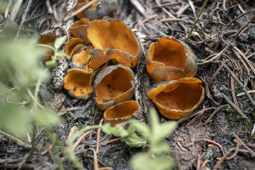
Orange Peel Fungus
The last time we were in this area we found quite a few mushrooms. There weren't as many this time, but we did find some Orange peel fungus.
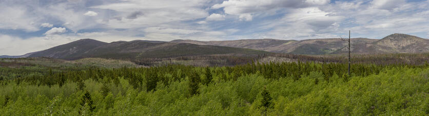
Green Aspens
The area of Pingree Park is covered with vibrant aspens. There's so many aspens from the fires that happened about a decade ago and the aspens are the first to recover. I imagine this would be a fantastic place to view fall colors in a couple of months.
In the distance on the mountainside, you can see the most recent fire burn line that came over the mountain. in a decade, that area will be covered with aspens, too.


