Sprague Lake
We headed into Rocky to get in another winter hike. Our plan was to start hiking from Bear Lake, but the road was blocked with a ranger right at the turnoff onto Bear Lake Road. I guess it was good that someone was right there telling us to turn around instead of wasting the 20-30 minutes driving up to Bear Lake and realizing that there is no parking, but I also like to think that we get lucky more often than not when trying to find parking at some trailhead along Bear Lake Road.
With our backup hike also along Bear Lake Road, we had to turn to our third backup, which was hiking to Sprague Lake from outside the park. There was irony in this since the easiest way to get to Sprague Lake is to drive to it from Bear Lake Road, but it's more satisfying to be able to earn the view. This is especially true since the best view of the hike wasn't even at Sprague Lake, which only had views of the mountain peaks surrounding the Bear Lake area. The best view was from the Glacier Gorge campsite which provided an unobstructed view of both the mountains surrounding the Bear Lake area and the Mummy Range.
This was the hardest hike we've done this year. We have done one hike this year that was more distance and elevation gain, but we were underprepared for this hike. We figured since there had been no snowfall in over a week in this area and since we started at a relatively low elevation that we wouldn't need our snowshoes. While that was true for about 95% of the hike, the remaining 5% where we needed snowshoes was pretty brutal without them. Every step would be a gamble with the snow Gods on if we would posthole down to our knees, which happened pretty frequently in certain parts of the hike.
One of our New Year resolutions was to beat one of our hiking stats that we did last year. Below is our hiking stats from last year, which can be found on the hiking page.
| Hike Count | Distance | Hiking Time | Elevation Gain |
|---|---|---|---|
| 45 | 154.8 miles | 85hr 56min | 32,312 feet |
| Last years hiking stats (2021) | |||
Last year was a crazy hiking year that included 2 hiking trips, and this year we don't have any trips planned specifically for hiking, so we thought that trying to beat just one of the above stats would be a good goal. Here's our current year to date statistics for the year:
| Hike Count | Distance | Hiking Time | Elevation Gain |
|---|---|---|---|
| 7 | 29.6 miles | 16hr 37min | 6,289 feet |
| Year to date hiking stats (Jan-Feb 2022) | |||
The above tables don't really mean anything without comparing them to where we are in the year. We're 2 months into the year, or 17% of the way through 2022. If I compare 2021 to 2022, you can see that we're above 17% for distance, hiking time, and elevation gain, meaning that if we keep going at the pace we're going, we should be able to easily complete our New Year resolution.
| Hike Count | Distance | Hiking Time | Elevation Gain |
|---|---|---|---|
| 15.6% | 19.1% | 19.4% | 19.5% |
| 2022 progress benchmarked against 2021 as the goal. | |||
This analysis fails to show how our hiking changes over the year. This is by far the most winter hiking I've ever done, and when we hike in the summer there isn't very much more hiking that we can really do since we're hiking nearly every weekend. So basically we would need to keep up this pace all year long to accomplish this New Year resolution which I'm not sure is possible. Not having those 2 hiking trips that we had last year, I doubt that we'll beat the number of hikes goal (and these numbers support that), but I'll have to see how the other statistics progresses throughout the year.
 5.07 mi
 2.9 hrs
 8,955 ft
 951 ft
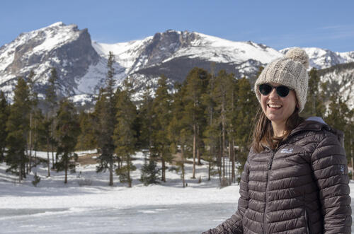
Cold
The wind was pretty strong in certain parts, but she powered through the cold since I had Katie take off her jacket because it made her look lumpy.
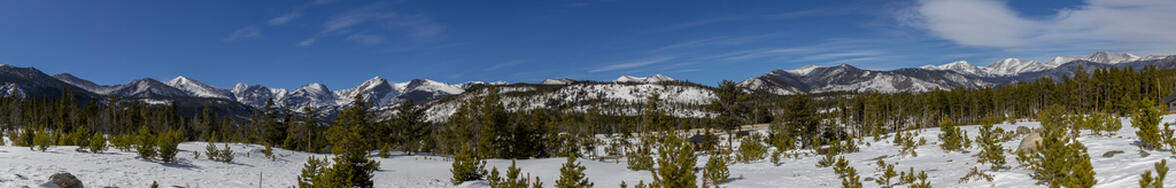
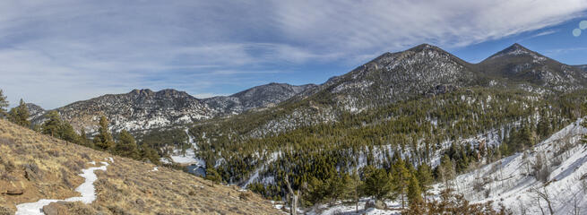
Sprague Lake
The mountain peaks left to right are Taylor Peak (barely visible), Otis Peak (the rounded one left of center), Hallett Peak (the jagged one right of center), Flattop Mountain, and Notchtop.
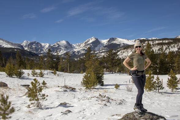
Portrait at the Lake
There was a deck that you could walk onto to get a good view of the surrounding mountains. Since the lake was frozen, we could have gotten the same view from literally on the lake, but this provided for a great spot to take a portrait.
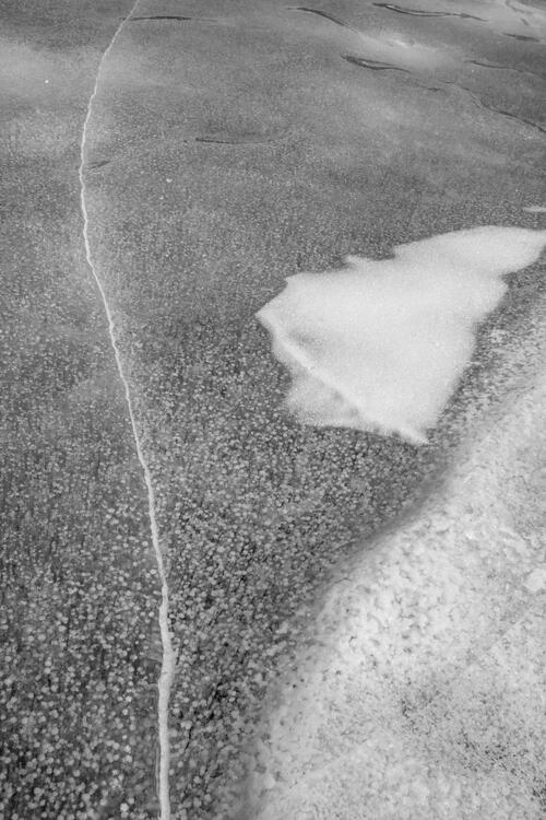
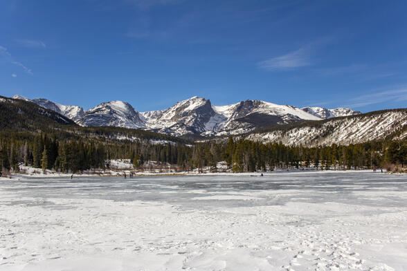
Cracked
The ice had a unique pattern to it, it's almost like there were air bubbles coming to the surface that were creating a trail as they came up. The pattern was so bizarre that I wanted to try and take photos of it.
Hiking Back
As we hiked back, the sun was lower in the West which made looking East much better from a photography standpoint.


