Bald Mountin
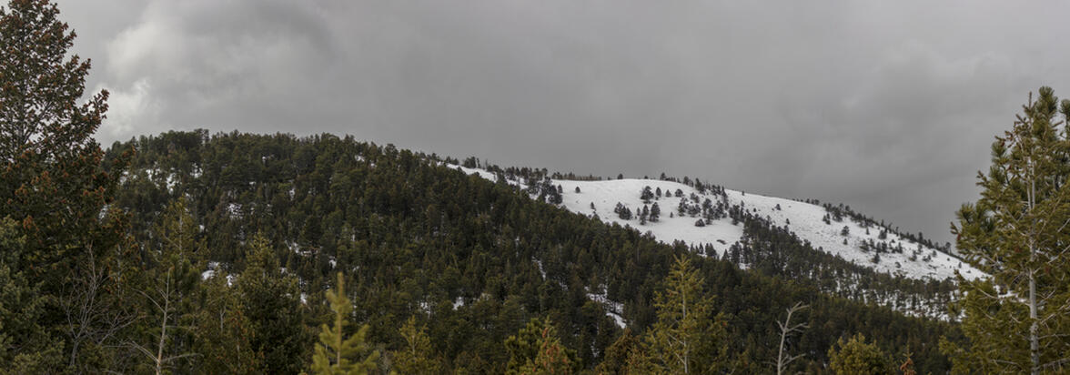
The mountains didn't get any snow this week, so we opted to do just regular hiking instead of snowshoeing. If we tried to go snowshoeing it would have been packed and icy, so we chose to stay a little bit lower in elevation (around 8,000ft) rather than going to our normal snowshoeing spots (around 10,000ft). We picked Bald Mountain which is up Boulder Canyon about 15 miles. Our hike started at the Sugarloaf Mountain trailhead and started off by hiking along the road for the first mile before the turnoff to go up Bald Mountain. The hike posed the entire 900 feet of elevation in the 3/4 of a mile once we turned off the road, which was quite the elevation to do trekking through the snow. Our assumption of not needing snowshoes was a good assumption. There were a few spots where snowshoes could have been helpful, but overall not having to carry the snowshoes up with us was the right decision.
The weather was pretty decent for us, partly cloudy and in the mid 20's (°F) with very little wind. Off to the East was clear and blue skies, but towards the Indian Peaks to the West were pretty harsh snowstorms that made for some pretty spectacular views being able to see a very drastic change in the weather just by turning your head. The storm got so bad that by the time we left the summit that we couldn't make out any of the Indian Peaks at all anymore. We didn't stay up at the top of Bald Mountain for too long because of the storms, even though they were pretty far away and didn't pose a real immediate threat, but the storms were pushing in just enough wind to make it uncomfortable to stay at the top. Despite the windchill, we stayed up at the summit long enough to eat our lunch before heading back down to the car.
The hike ended up being a little less than 4 miles round trip with about 900 feet of elevation gain. The whole hike took up just over 2 hours. Someday we will come back to hike up Sugarloaf mounting which is an even easier trail with less distance and less elevation gain.
 3.73 mi
 2.1 hrs
 9,253 ft
 892 ft
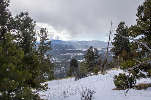
Storm is Starting
The storm was starting over the Indian Peaks when we were headed up.
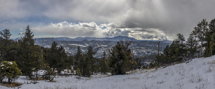
Sun Peaking Through
The clouds were pretty light where we were. You could see the sun just asking to come out of the clouds, and it did periodically throughout the hike.

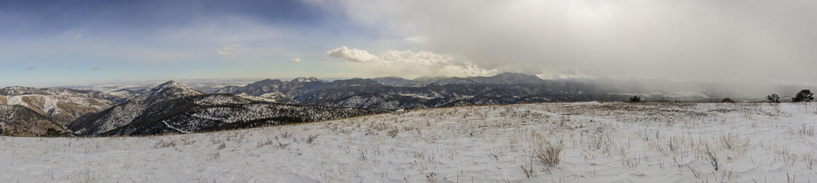
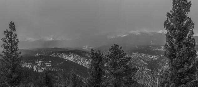
Hidden
By the time that I got to a place that I could overlook the Indian Peaks, the storm had completely taken over. This photo is taken directly West towards the area that we were snowshoeing two weeks ago at Brainard Lake.
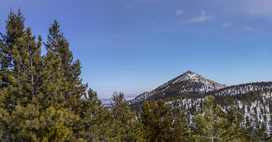
Sugarloaf Mountain
On the descent, we got some great views looking at Sugarloaf Mountain.