Trekking Through The Forest
This November has been quite an unseasonably warm one. Most every day, I look at the photos that I've taken on the same day but in previous years (from my homepage), and just a few days ago, there was an album from 2017 where I was bragging about how we had a couple of warm days where I went on a hike. Now it's 2021 and we haven't even gotten a serious snow yet in Colorado, something that usually happens in October or at least early November. I'm certainly happy about the warm weather because it means that I can go hiking and still do other outdoor activities, but it also means that Colorado will stay dry and I would much rather have the moisture so that fires don't start in the mountains in the middle of November (I'm talking about the Kruger Rock Fire up in Estes Park). Let's hope it's a wet winter...
But I digress. We didn't want to go too high up into the mountains because the high mountains are actually cold (although still lacking snow for us to snowshoe), so we picked a hike just outside of Allenspark which started at an elevation of just under 9,000 feet. The hike up to Taylor Mountain and Big John Mountain is a pretty easy hike that starts on forest Roads. We even drove up to forest road 330 to make the hike shorter. The hike was just under 4 miles in distance and 1,100 feet in elevation gain which took us almost 2.5 hours.
This is not a frequently trafficked trail. We saw one group hiking down the forest road as we were driving up, and there was one more car parked next to us when we completed our hike (but we never saw that group). The trail to get to the fork for Taylor Mountain was pretty easy to follow, but the trail up to Taylor Mountain was non-existent and the trail from the Taylor Mountain fork to Big John Mountain was incredibly well marked with cairns, yet we still managed to get lost by following a rogue cairn. On the way back down, we were able to follow the path a little better, and even set up half a dozen new cairns for hikers so they don't get lost in the same way that we did. Once we got back to the area where we followed the rogue cairn, we kicked it over so that no one would get lost. I kicked over a total of 3 misleading cairns on the hike back, which made me feel like I did my duty as hiker by helping out future hikers.
The other cool thing about this hike is that there were two hiking logs at the top, one at Tylor Mountain and one at Big John Mountain. Both logs dated back to 2011 which is pretty long to survive up in the elements. It was exciting because I've only found one other hiking log before (at Stone Mountain). Both of the logs were just off the scenic view and protected by tall cairns. The log at Taylor mountain was in pretty bad shape, including cracks in the plastic jar plus the plastic bag around it being completely torn up. I always keep a gallon zip lock bag in my backpack in case it rains and I need to protect my camera, so I figured giving it up for the hiking log would be a worthy cause. The log at Big John Mountain was in much better shape in a plastic container that was holding together pretty well (which is good since I didn't have any more bags left).
The lack of people, the adventure of getting lost and trying to find, build, and destroy cairns, signing the hiking logs, and the great views made this a pretty fun hike.
 3.88 mi
 2.4 hrs
 9,220 ft
 1,132 ft
Taylor Mountain Fork
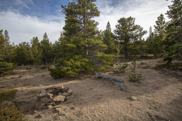
At about 3/4 mile into the hike, you reach a fire pit that marks the fork to get up to Taylor Mountain or to continue on to Big John Mountain. We stopped at Taylor Mountain on the way up first before heading on to Big John Mountain.
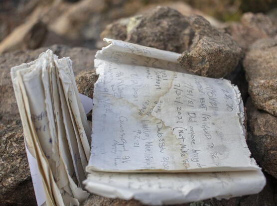
Signed Log
I signed the log in the middle of a random page that happened to be a page where a lot of people already signed for 2021. At least where I signed was in a random spot and not conforming to the current format.
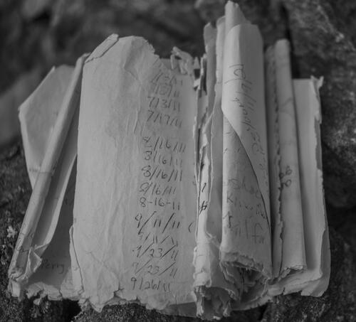
Dated Back to 2011
I looked through the log a little bit to find the oldest date. It seems like the log was started sometime around 2011.
Obstructed View
This was the best view we could get up at Taylor Mountain. The view was pretty great but was obstructed by a few trees.
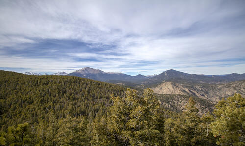
Opened Up
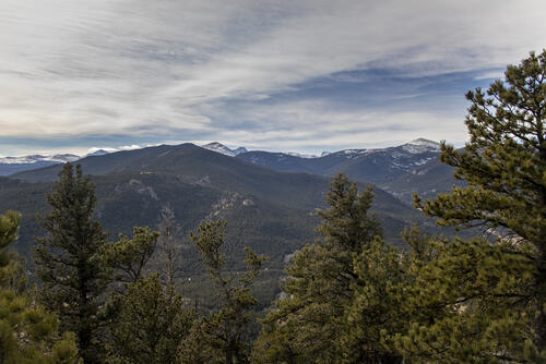
The trail opened up at one point on our way up to Big John Mountain. It wasn't the most unobstructed view, but it did give a fantastic view of Rocky Mountain National Park. The peak in the center-left of the photo is Meeker Peak and is hiding the one 14'er that we have in Northern Colorado - Longs Peak.
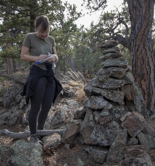
Signing the Log
Katie signed the log that we found up at Big John Mountain. The cairn that the log is hidden in is almost as tall as her!
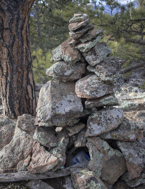
Hidden in the Cairn
You can see the plastic box that the log sits in that's hidden at the top of Big John Mountain.
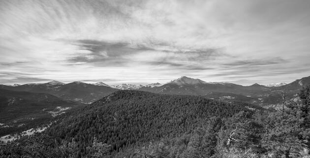
Washed Out
By the time we summited Big John Mountain, the sun was too low and had started washing out the mountainside. Washed out mountains always look better in black and white, so this is the best shot I could get with the lighting I had. The mountain directly in front and center in this photo that's covered in evergreen trees is the mountain we had just hiked from, Taylor Mountain.


