Accidental Hike Towards Stormy Peaks
We went into Pingree Park this weekend to hike the B-17 crash site hike where a B-17 plane crashed in 1944 killing 4 of the 10 person crew. I've been wanting to hike this area for a while, but the distance to get there has always been a deterrent since it takes almost 2 hours to get to Pingree Park. It's not that Pingree Park is that far away from our home, but the drive has a 20 miles stretch of unpaved road that you can't drive very fast on. I've never been to the Pingree Park area, again because of the drive time, but I'm happy to have gotten to finally explore this area. The Cameron's Peak fire almost went through Pingree Park last year. But in this area, the fire seemed to skip certain patches of trees and obliterate others which made for a fascinatingly sad but colorful hillside.
We got to the trailhead and at the fork about a half-mile in, we went the wrong direction and never made it to the B-17 crash site. Instead, we were headed towards Stormy Peaks. Once we realized that we were headed on the wrong path it was too late to fix our mistake, we decided to hike about the same distance we were originally planning on doing and call it good. It started to rain on us during the last half-mile of the hike on the way back to the car, so it's good that we turned around when we did and didn't try and go further on the Stormy Peaks trail. But let's be honest, we would have never made it all 6 miles one way and 3,500 feet in elevation to the Stormy Peaks summit anyway. It wasn't raining hard at the end, but a little more than comfortable rain while hiking. We saw several people hiking up while we were heading down, and with Stormy Peaks above the tree line, I hope they didn't get caught in a storm.
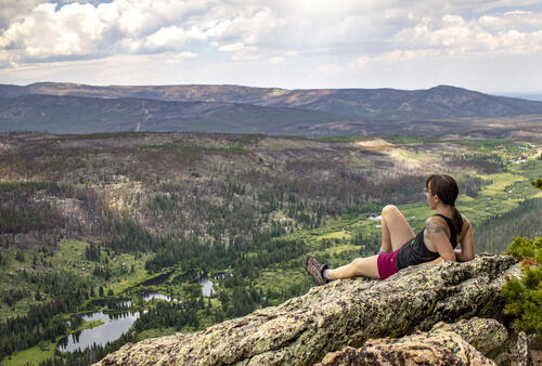
After about 2.5 miles we passed an amazing overlook. We stopped to take some photos and continued on, but didn't make it much further. At the 3-mile mark, we turned around and stopped at the same overlook to eat our lunch. The view was gorgeous and stunning in a breathtaking and sad way because of the burn scars on the mountainside. Because Pingree Park is home to the CSU Mountain campus and many other buildings, the firefighters fought pretty hard to keep the Cameron's Peak fire from engulfing the area. They did succeed in this area, but the fire got very close which is evident in the photos where the green trees quickly turn black.
Our hike ended up being just over 6 miles and 1100ft of elevation gain which took us 3 hours to complete.
 6.18 mi
 3.1 hrs
 10,141 ft
 1,148 ft
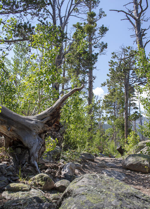
Uprooted
There were many uprooted trees on the path to Stormy Peaks. There were several areas that were almost impassible because of downed trees and made for a very rugged hike.
Getting Cloudy
The clouds started to roll in after about an hour of our hike. It provided some much needed cloud coverage.
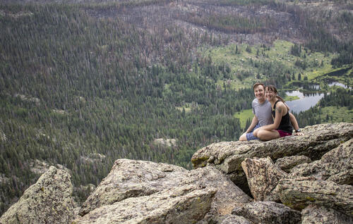
Lunch Spot
We found an amazing overlook where we ate some sandwiches that we brought with us. I was able to balance my camera on a tree branch to get this photo of us. Even though it looked pretty sketchy, my camera was actually quite stable.
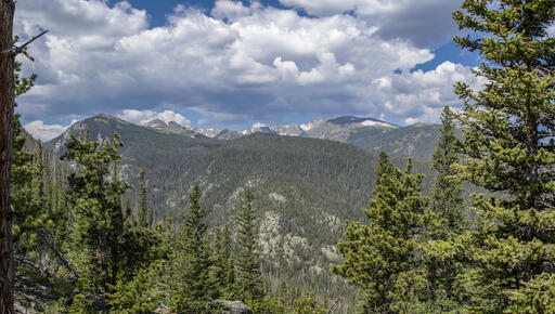
Burn Scars
The burn scars are very obvious in this photo. It was pretty stunning seeing where the fire went and the areas that it skipped over.
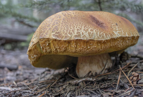
Wild Mushroom
We passed by an area that had a lot of mulch and was pretty damp. There were tons of different types of mushrooms in that area.
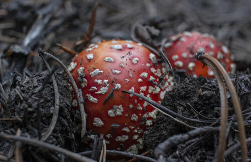
Fly Agaric
This is a Fly Agaric mushroom, also known as a Amanita muscaria.
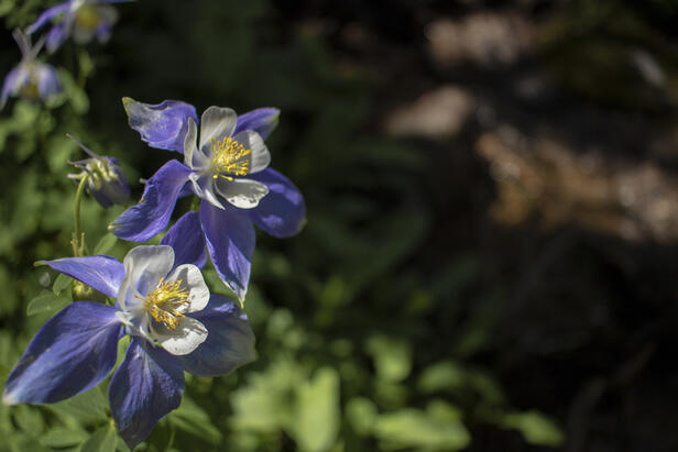
Columbine
The Hike to Stormy Peaks was covered with wildflowers, including several patches of Colorado Columbines,
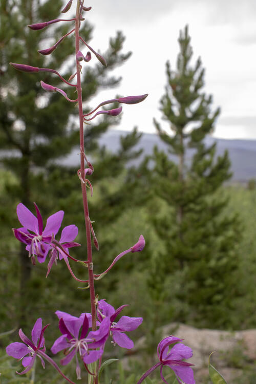
Fireweed
I don't know that I've ever seen this wildflower before which is a Fireweed. This area was covered in them and it gets it's name from being able to spread so quickly.
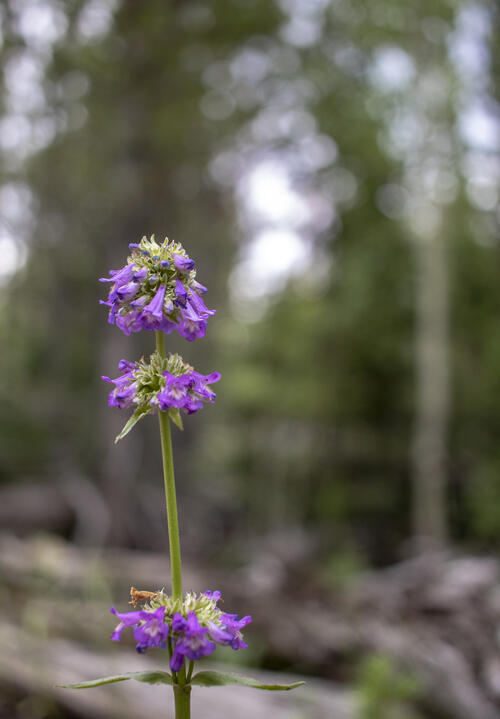
Multi-Level Primrose
I think this is a Capitata Primrose plant. Most photos of this flower on line are only a single layer, so I might be wrong in this identification.


