Bighorn Lake
Bighorn Lake was a tough challenge. Having hiked a moderately difficult hike the day prior, plus poorly sleeping from camping, I'm quite impressed that we made it to another alpine lake that was even further and higher than the hike prior. But we had all day to accomplish it, so we took our time. 5 and a half hours to be more precise. considering we've done similar length and elevation hikes in about 3 and a half hours show how lazy we were on this 8.5 mile and 1,400-foot elevation hike. Our first main break was where the river that runs off of Lake Katherine meets the Lone Pine Creek. We encountered this one the day before since Lake Katherine and the Bighorn Lake trailhead start at the same place, so we knew this would be a great resting point which was less than a mile and a half into the hike. We took off our boots and stuck our feet int he freezing cold water. The lakes are at 10,000 feet, so the water is quite cold since it's from snowmelt (yes, even in July). We didn't have our toes in the water for long, but we did eat some cookies and relax for about 20 minutes before proceeding down the new path that we hadn't been on to get to Bighorn Lake.
We got completely lost on this hike. But we weren't concerned since my watch tracks our location and since Katie had a map downloaded to her cell phone and she had GPS signal. We were trying to follow the phone map, but the map wasn't quite up to date and we headed down what looked like a legitimate path, which quickly turned into a deer trail, and then eventually nothing. We knew the trail followed the river for a little bit, so we followed the river and eventually caught up to the trail. I will say the path we took seemed less steep even though we didn't go too much farther in distance. So maybe getting lost was a good thing?
When we made it to the lake, we were the only ones there. We sat and ate some lunch and relaxed while looking over the lake. It was beautiful, and being alone made it all that much more peaceful. We proceeded to try and make it to the far point on the lake. We stopped on the shore by a rock that was perfectly shaped like a recliner where we sat for a little longer until we weren't alone on the lake anymore and another group of hikers had summited. We proceeded to the far end of the lake which was spectacular and worth the trouble of crossing over an almost-waterfall to get to a glacier-looking area that we walked onto. The snow gave a blueish hue to the lake that was almost surreal.
Just another 500 feet above a steep rock face was the continental divide which was a crazy thing to stop and think about - the snow we had been standing on and all the snow we could see still on the peaks around us would fall into this lake and end up on the East side of the country.
 8.49 mi
 5.4 hrs
 10,074 ft
 1,430 ft
Quiet Morning
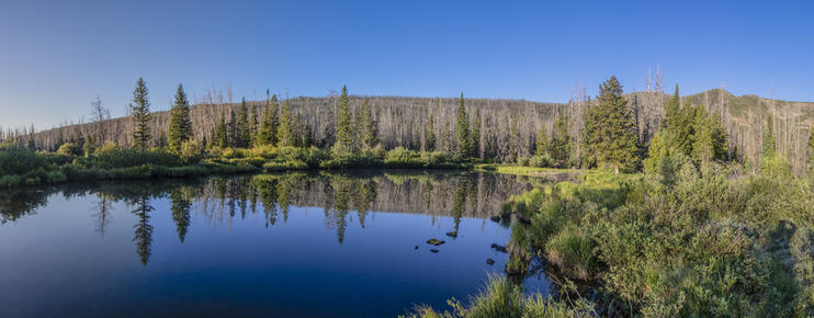
I woke up when the sun started to come up so I went for a small walk. Our camp site was located pretty close to a small lake, so I went to go take some reflective photography since there wasn't any wind.
Reflective
I stood outside looking at the lake for about 30 minutes trying to get photos of the birds swooping down into the lake to catch some breakfast. Unfortunately none of the photos turned out with birds in them.
Morning Frost
It got down to 35° the first night that we camped, so all the grass and flowers were covered in a small layer of frost.

Mount Zirkel
The area that we were hiking and camping in was known as the Mount Zirkel area inside of Medicine Bow-Routt National Forest.
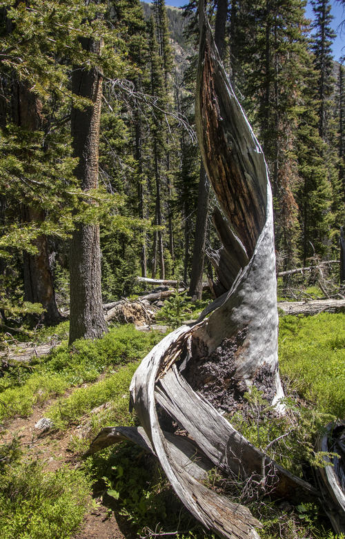
Twisted Hollow Trunk
I thought this tree trunk was pretty cool. The lighting wasn't as perfect as I'd like it to be to get this shot but it still ended up okay.

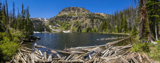
Log Bridge
These logs, fallen from the nearby mountains, created a great bridge to cross where the lake turned into a river.
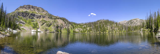
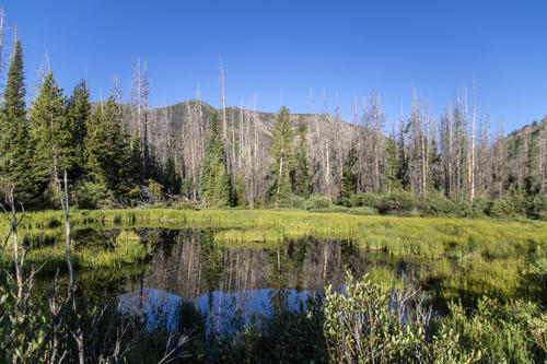
Bighorn Lake
The lake is just below the continental Divide trail, located at the top of the mountain feature to the left in this photo.
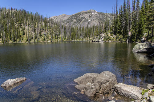
Reclinier Rock
We sat on this rock for about thirty minutes because it was perfectly the shape of a recliner.
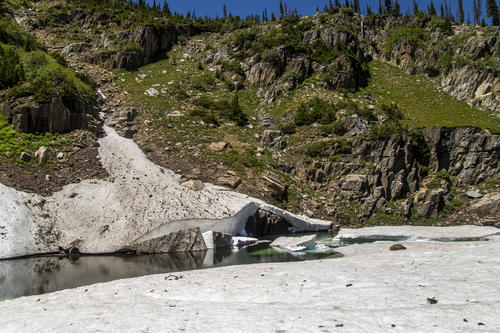
Small Glacier
There was still plenty of snow to melt. I imagine it'll be there well through July with how deep the snow went below the ice.

Snowy
It's always fun to go hike places with snow. There hasn't been snow where we live in several months now, but there's still plenty of snow in the mountains.


