Gray Rock
The hiking gods were against us today. Well at least me. As soon as I left the car, I turned on my GPS on my watch and the screen went blank. It's done this before and usually takes me plugging it in to get it to turn back on. I didn't have the charger with me so I was out of luck. The thing was at full battery so I was pretty disappointed that it decided to not work for this hike. As such, I don't have accurate geotagging for any of the photos, along with accurate mileage or elevation. Oh well.
the second thing that went wrong was after I took the first photo. I realized that there was a pretty fuzzy section in the corner of the photo. Turns out my UV filter was completely shattered. Easy enough fix, I just took the filter off. But it was still pretty baffling to find a shattered UV filter considering that takes a pretty hefty drop to break one of those and I think I would remember dropping my camera like that.
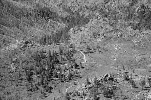
This was the hardest hike we attempted. With over 1,000 feet more elevation gain of any other hike we've done, this hike comes in at half a mile of elevation gain in 4 horizontal miles of hiking (round trip just over 8 miles). Considering it took us four and a half hours, I'm just glad we survived. We got lost a few times including one time when we were full-on mountaineering down some very steep rocks trying to find the trail. The hike itself had some spectacular views at the summit. It was pretty hazy, so I'm sure the photos don't do it justice, but other than the panoramic views there were some blooming wildflowers and a gorgeous green meadow. On the other side of the loop trail, we hiked through a burn area (from the Hewlett's Gulch Fire in 2012) that was starting to recover.
 8.5 mi
 4.5 hrs
 7,616 ft
 2,421 ft
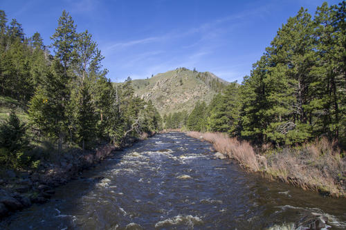
Crossing the Poudre
The hike starts by crossing the Poudre river.
Up High
We climbed up pretty high taking the meadow route. We thought maybe that the longer route meant less steepness, but instead it was just as steep, it just had a section that you had to climb down before climbing back up to the summit.
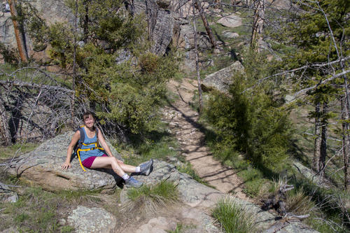
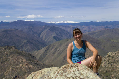
Taking a Break
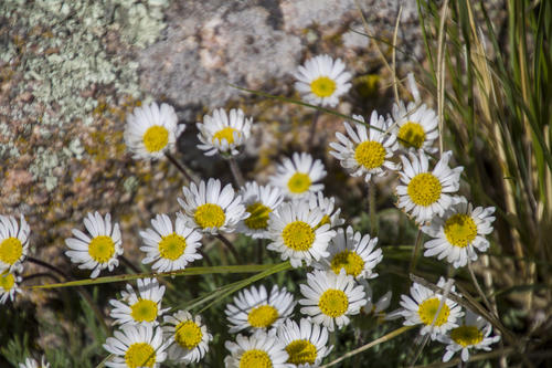
Wild Flowers
The wild flowers were starting to bloom and fill the mountainside with color.
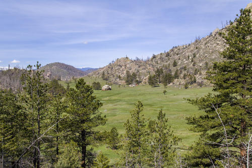
Gray Rock Meadow
This is the meadow we hiked through. It was beautiful with the new grass and green everywhere.
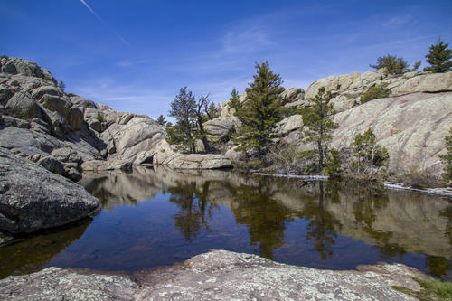
Summit Lake
Usually the summit of a mountain is a point. This one had a lake just before the point. It was pretty magnificent to see a lake on the top of a mountain.
Trail Split
From the summit you could see where the trail split. To the left was to the meadow and straight was following a small creek that connected back up with the Poudre.
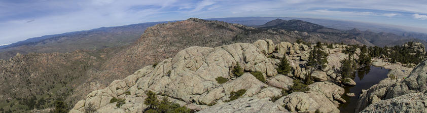
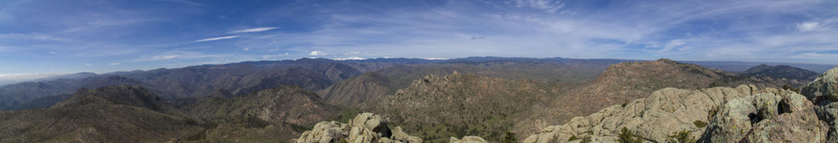
Summit Lake Panorama
This panorama is looking Northeast from the summit.
Half Way Done
The summit marks the half way point. We were both ready to be done at this point but there's no option but to climb down once you've climbed up.
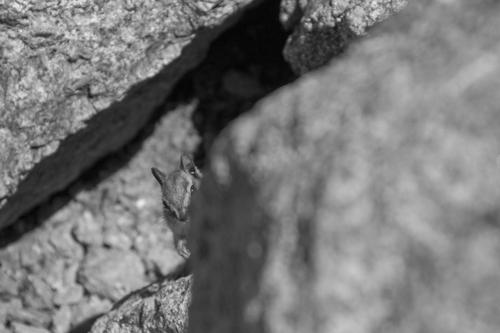
Little Scavenger
There were a bunch of little critters at the summit hoping for hikers to drop food for them.
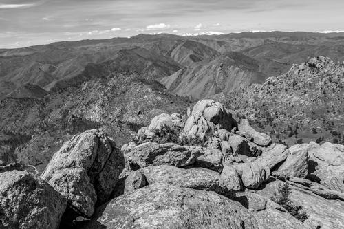
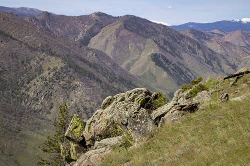
High
Gray Rock is the highest point in the Graysill Mountain Range. Because of this, it provides excellent views of all the surrounding peaks and mountain ranges.
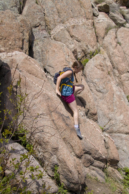
Wrong Way Down
We took a wrong turn (the trail is pretty hidden at the summit), and it resulted in Katie and I climbing down some pretty sketchy rocks to make it back to the trail.
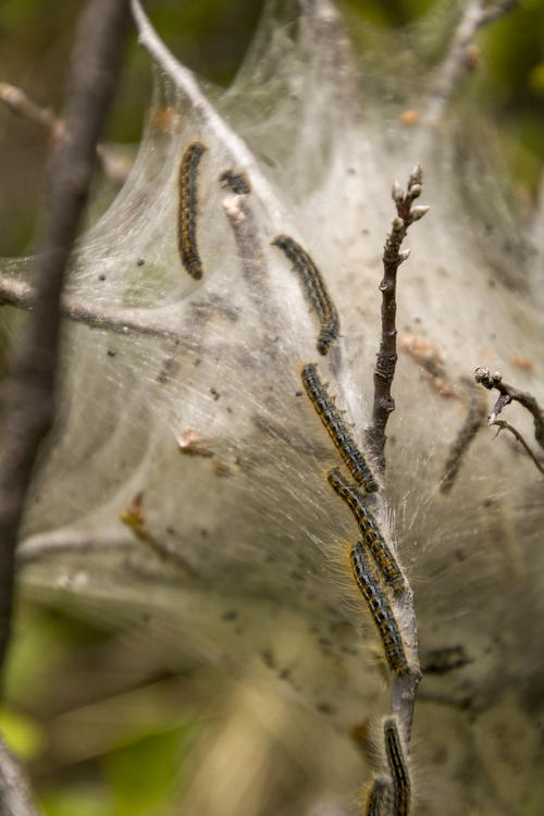
Tent Caterpillar
Right off the trail was a nest of tent caterpillars. I've never seen this before so it was pretty cool to look at.
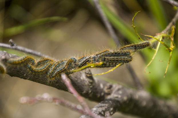
Hundreds
I don't know how many caterpillars there were, but they were everywhere crawling on this bush.


