Four 14'ers in One Day
Katherine, Will, and I decided to hike four 14'ers in one day. Are we crazy? Yes, definitely. But all four of them were in a row and not too difficult to get to. Democrat, Cameron, Lincoln, and Bross are the four we hiked. Technically, Cameron isn't a true 14'er because there isn't enough drop distance between the saddle between it and Lincoln, but I count it anyway because it is a peak and it is above 14,000 feet.
The hike was 7 and a quarter mile long with almost 4,000 feet in elevation gain. That's the most elevation gain Katherine and I have ever done in one hike by about 1,500 feet. We spent the night at Katherine's parent's house in Highlands ranch to get a little bit closer to the trailhead. Our morning started at 3:30 am waking up to drive to the trailhead where there were already a good 50 cars parked by 6:00 am. I was shocked at how many cars were there but you have to start a hike this early to get all 4 of them completed before the weather rolls in. We completed the hike around 12:30 and headed back home. It was a great hike that provided a lot of different scenery, but it was one of the most difficult hikes we've ever done.
 7.23 mi
 6.2 hrs
 14,303 ft
 3,973 ft
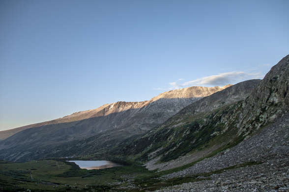
Early Morning Sun
We got started pretty early, the hike started just after 6am. When we started hiking, none of the mountains we were hiking had any sun on them.
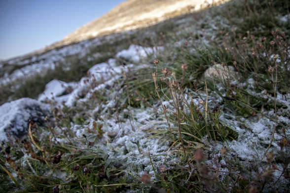
Morning Frost
The trail was pretty icy during the first few hours of the hike. Until the sun hit the mountain, every step had to be carefully planned.
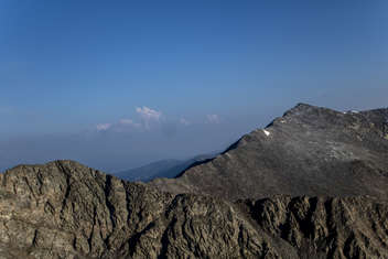
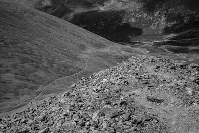
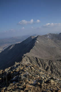
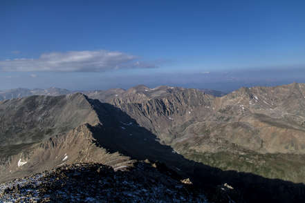
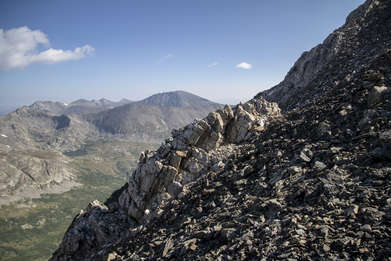
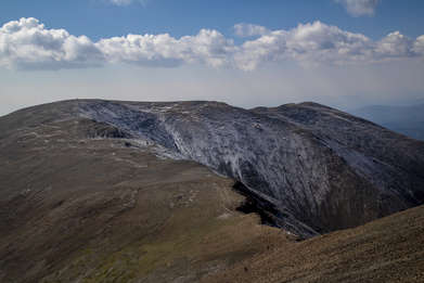
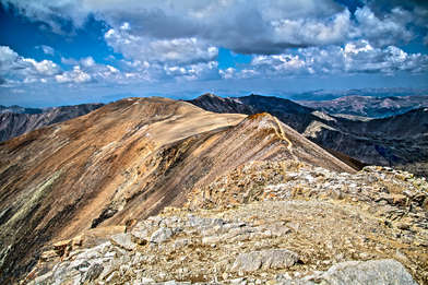
Ridges Everywhere
Once we got up to about 13,000 feet, you could see ridges going off in all directions.
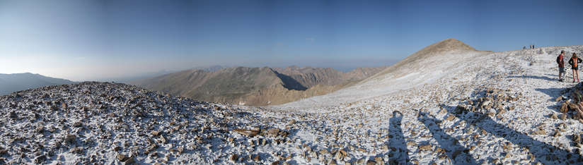
Three Shadows
It's the beginning of August and it snowed up here the night before.
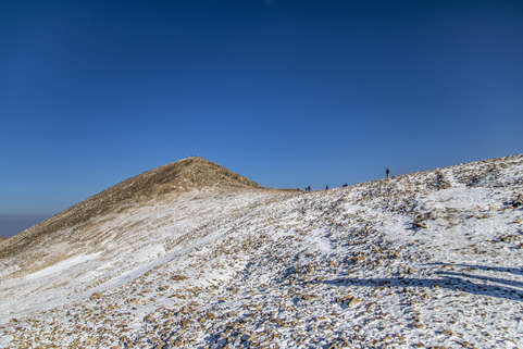
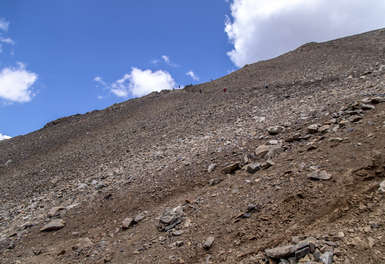
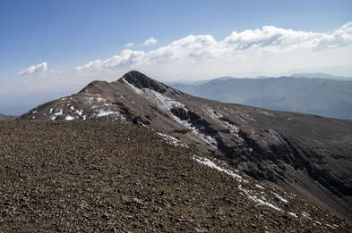
Close to the Summit
We got over a ridge to find a false summit. You can see Mount Democrat in the distance.
Northern Ridge
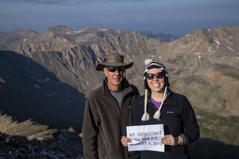
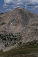
Mount Democrat
We made it to the summit in 1 hour, 48 minutes. We had hiked 2.07 miles and 2003 vertical feet. Mount Democrat is at an elevation of 14,148 feet.
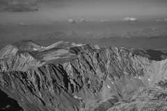
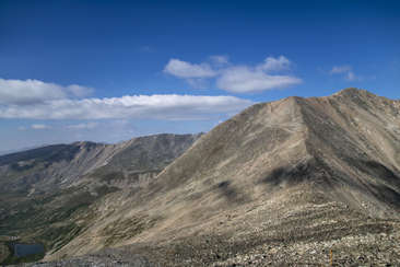
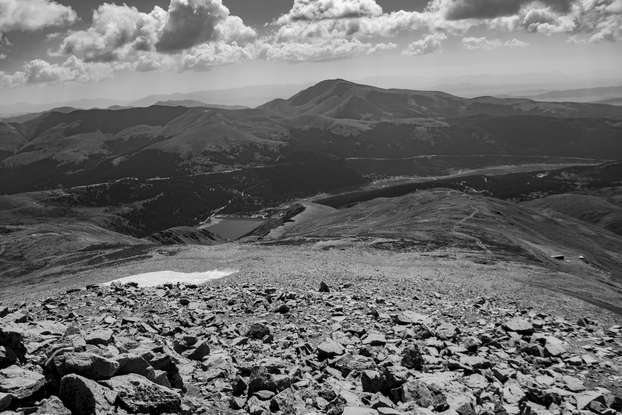
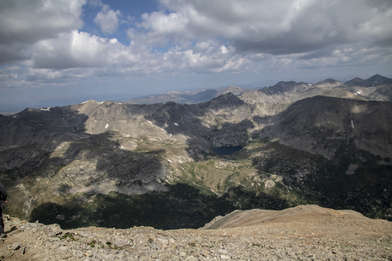
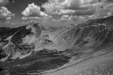
Far Mountains
It was pretty smoky from all the fires in Southern Colorado and California. But you can barely see the mountain range far away from the range we're on.
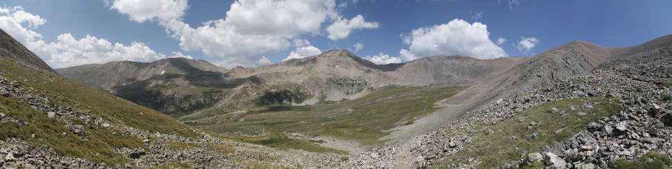
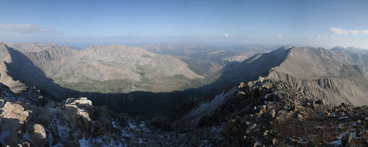
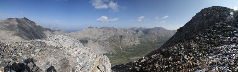
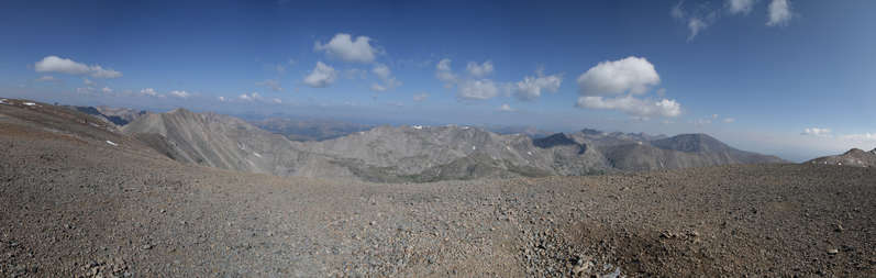
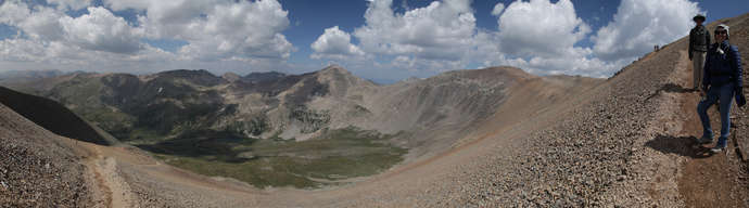
In the Saddle
This panorama was taken between Mount Democrat and Mount Cameron. Mount Cameron is directly in the center of the photo.
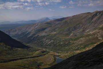
Sunlight in the Valley
Finally the sun rose enough to light up the entire valley.

On Our Way to Mount Cameron
Mount Cameron isn't too much further from here!
Mount Democrat
You can see Mount Democrat to the right, and the false summit in this photo.
Rocky Path
The path continued on to the right in this photo. Up the Rocky path.
Off the Edge
This is where I started getting into trouble for hiking too close to the edge. Katherine did not appreciate it.
Path to Mount Bross
Before we summited our second 14'er, we could see our fourth 14'er, Mount Bross.
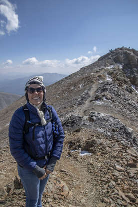
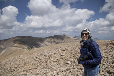
Person in Blue
We summited Mount Cameron and could immediately see our next destination in the distance, Mount Lincoln. The highest one of them all.
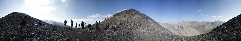
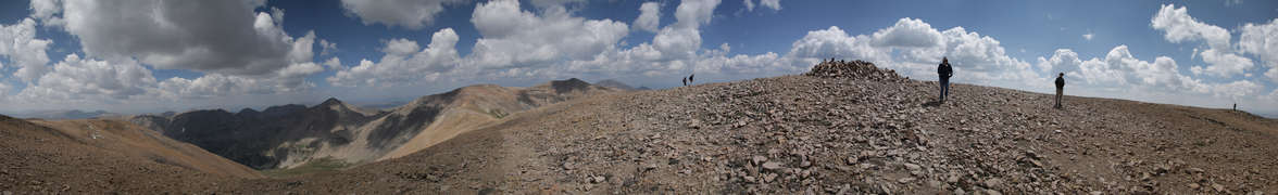
Mount Cameron Panorama
Mount Cameron was really windy. We didn't stay very long. Just long enough to take some photos with a sign and keep moving on.
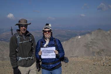
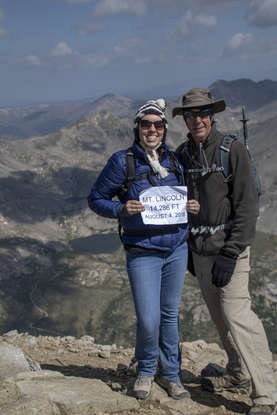
14,238 Feet
We summited Mount Cameron in 3 hours, 26 minutes. Total distance traveled was 3.63 miles, 2908 vertical feet.
On to Lincoln
We headed on quickly to Mount Lincoln to get out of the wind. Here is Katherine on the path to Mount Lincoln.
Mount Lincoln
We summited Mount Lincoln in 4 hours, 1 minute. Total distance traveled was 4.20 miles, and a total ascent of 3,245 vertical feet. Mount Lincoln is at an elevation of 14,286 feet.
Lunch On the Mountain
It was not even close to noon, but we ate our lunches and took a 15-20 minute break on the back side of Mount Lincoln.
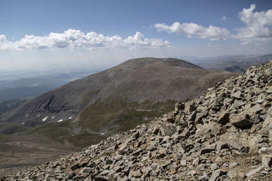
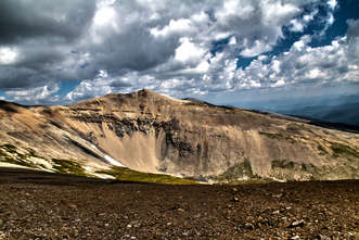
Mount Bross
We could see out final destination, Mount Bross, from Mount Lincoln. It looked so far away, but we were past the point of no return and that was the quickest way back to the car, so we decided to hike on.
Patchy Clouds
The clouds started to roll over the mountains in the late morning. Luckily we didn't get caught in any storms.
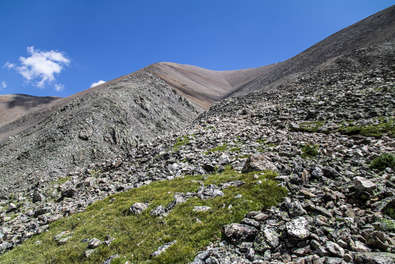
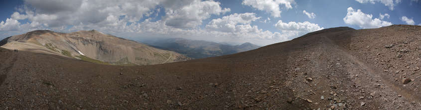
Trail to Mount Bross
You can see the trail going up and over that small peak to get to the final destination a little bit further.

Mount Lincoln
You could see Mount Lincoln the entire way to Mount Bross. It looks so small from here, that means we must be getting close!
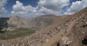
Almost There
The ridge wasn't too steep getting to Mount Bross. It was a pretty long distance though. The summit is just to the right of this photo.
Mount Bross @14,172 Feet
I snagged this photo right as we summited. Of course Katherine is happy because now it's only down from here. No more up!
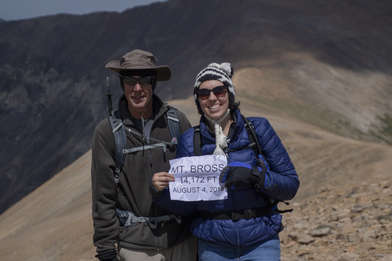
Summited Mount Bross
5 hours, 9 minutes into our hike and we summited our last 14'er - Mount Bross at an elevation of 14,172 Feet. Total distance traveled so far was 5.80 miles, 3,847 vertical feet climbed.
First Peak In the Distance
You can see the first 14'er we accomplished, Mount Democrat, to the left in this photo. We hiked the ridge all the way from the left around to the right.
Mount Democrat From a Distance
This is mount Democrat as seen from the descent from Mount Bross.
Steep Descent
The descent from Mount Bross was really steep. The entire way down was a very difficult balancing act where you had to be very careful where you stepped.
Down the Ridge
We hiked down the ridge for the first half of the descent.