Lions Head and Bear Mountain
With the wedding over, Katie was now free to go hiking with me in Connecticut. We only had one full day left after the wedding before flying back, so this was our last chance. The hike chosen was Lions Head and Bear Mountain. We had this hike planned out before we left for the trip, as opposed to the last two hikes where I figured out where I was going the night before. Since we knew we would have this day to ourselves it was much easier to plan it out in advance.
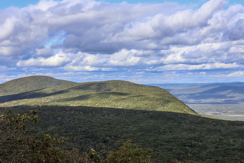
In the morning we packed up our things and left for the very top corner of Connecticut where New York and Massachusetts border it. This hike has the highest point in all of Connecticut, with an altitude of 2354 Feet high. It's silly to think that our house is at double that elevation, but it was cool to get to the high point in the area to be able to have a great panoramic view. However, since we were bordering two other states, it wasn't the high point in the area. Looking over towards Massachusetts had a mountain that looked just slightly taller than the one we were on. Oh well...
The views were great but not really that impressive since none of the foliage has begun to change here. Although the lighting was better in some ways than the past two days since there was actually sunshine, there were lots of clouds which made for patchy lighting that wasn't ideal. I think I prefer the sun with patchy skies over hiking in the rain, but it made it difficult to capture what we were seeing with our eyes.
It was a good hike with more distance than I did on my other hikes. However, having been up until 1 am from the wedding the night before and having danced a lot, both of us were very exhausted on this hike. I might have liked this hike more if we were both a little less tired, but this was Katie's only day and our only day completely together to go do something fun. So even if the hike wasn't that great and even if we were both completely dead, we still had a good time out exploring a new state with each other.
 8.59 mi
 4.1 hrs
 2,377 ft
 1,805 ft
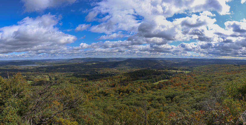
Lions Head Panorama
The clouds made it possible to get a panorama since the sun was in front of the lookout. This photo would be so much better with more fall colors in a few weeks.
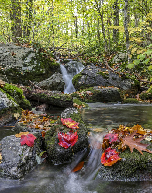
Fall in the River
We came across a small river that was perfect for photographing. I staged the maple leaves on the rock to make this a more complete photo which ended up being perfect and my favorite photo from the trip.
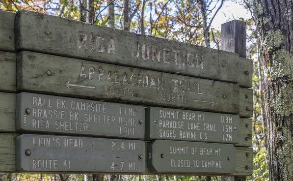
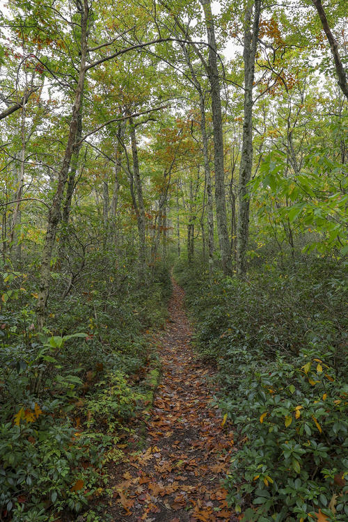
Appalachian Trail
We were hiking on the Appalachian Trail which was a cool thing to do. We have hiked on this trail in a different state before.
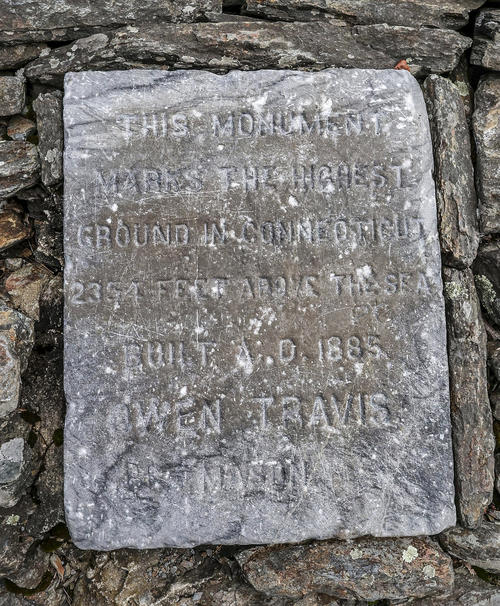
High Point Plaque
Since it's hard to read, this plaque says the following:
This monument marks the highest ground in Connecticut 2354 Feet above the sea
Built A.D. 1885
Owen Travis
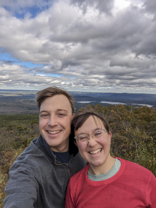
Summit Selfie
We have a map in our house that we can put photos of all the places we've been together in the United States. We took this selfie to put on the map. That's one more state visited!